SpatialSuperVision - Innovation Norway
Project title: SpatialSuperVision
Fund operator: Innovation Norway
Project promotor: Geometricus d.o.o
Case number: 2023/363863
Grant type: Croatia innovation Norway grants
Supported by a grant from Norway through Norwegian Financial Mechanism 2014-2021, in the frame of the Programme "Business Development and Innovation Croatia"
Status: In implementation
Total value:
1.414.956 EUR
Grant:
983.000 EUR
NEW PROCUREMENT:
Online procurement No 2024/5, 04/04/2024
Short description: ICT equipment - BigData computer and working stations and terrain data processing notebooks
Procurement number: 2024/5
Deadline for submission of offers: April 11th, 2024
Invitation to bid - 2024/5
Annex 1 - bid submission form - 2024/5
OLDER PROCUREMENTS
Online procurement No 2024/3, 20/02/2024
Short description: Total station 3D scanner
Procurement number: 2024/3
Deadline for submission of offers: March 1st, 2024
Invitation to bid - 2024/3
Annex 1 - bid submission form - 2024/3
Online procurement No 2024/4, 20/02/2024
Short description: Air pollution measurement device
Procurement number: 2024/4
Deadline for submission of offers: March 1st, 2024
Invitation to bid - 2024/4
Annex 1 - bid submission form - 2024/4
Project summary:
The focus of the project is introduction of environmentally oriented measurement services with ability of total coverage of spatial features – concrete and abstract as well as above ground and underground, as a new green technology in application.
The need or the problem that project addresses is mainly poor spatial datasets for underground utilities which are in use (or in absence, not in use at all), as well as generally low-definition of spatial datasets of urban areas which fact brings to inappropriate urban sprawl and poor urban area management on damage of environment. The technology progress enables our geodetic company to provide the sector experts – the urban designers, physical planners, authorized bodies in climate change management, persons in charge for natural disasters prevention and response, underground utilities management bodies, the ability to quality engage the measures in planning and maintenance of urban areas in-line with the Smart City initiatives as well as outside agricultural and forest areas, i. e. total spatial coverage.
The project has 4 activities:
1. Procurement of equipment:
a. Mobile Mapping System (MMS)
b. Ground Penetrating Radar
c. Underwater (under liquid) robot
d. Airborne geomagnet set
e. Airborne echosounder set
f. Multi-spectral COMBO
g. Air-pollution measurement device (sniffer)
h. The set of processing computers
2. Technical consultancy services
3. Project management
4. Publicity and visibility
Announcement:
The first set of equipment has been delivered. The MMS and GPR from Leica, as well as multi-spectral combination of instruments from Ricopter have been procured.
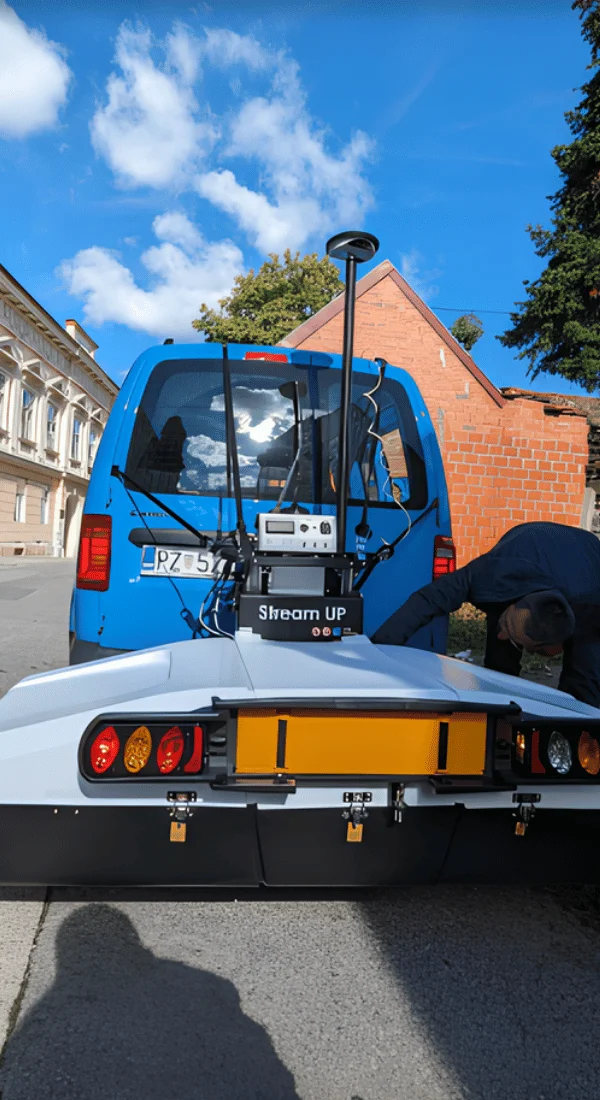
Stream UP GPR
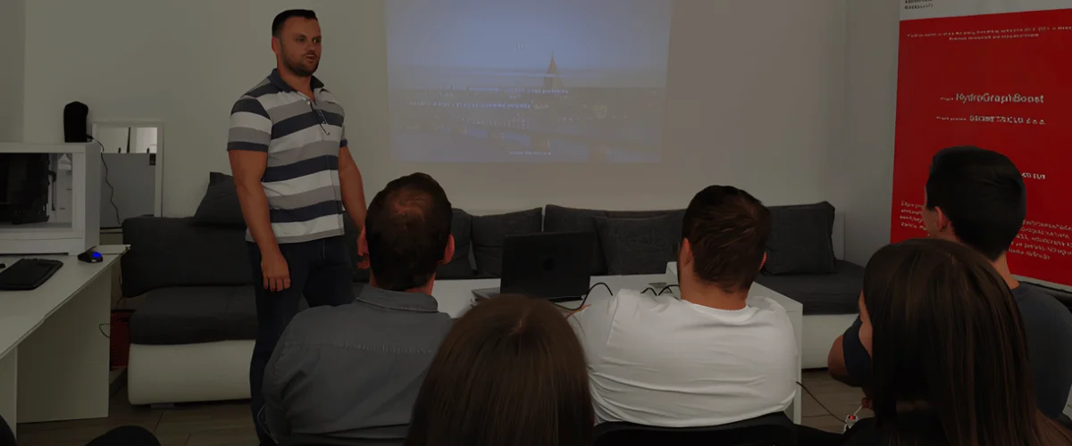
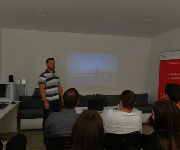
Kick-off meeting
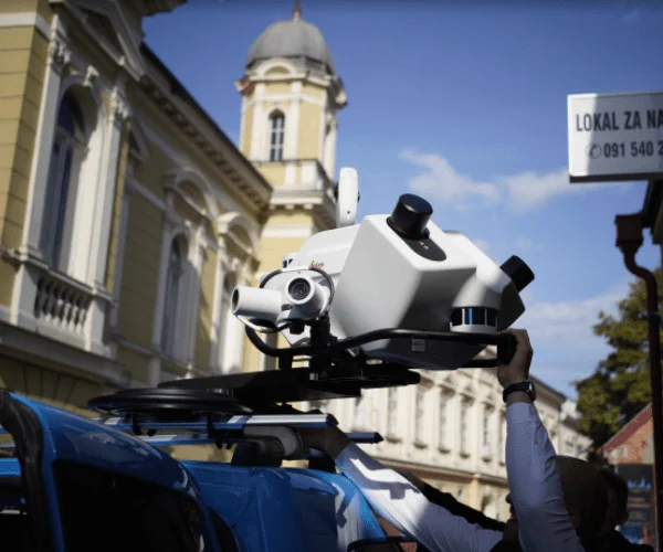
Leica TRK Evo 700
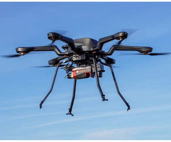
Multispectral combo
Training is in progress.
The SpatialSuperVision kick-off meeting and first project conference was held in the business offices of GEOMETRICUS d.o.o.
Project promoter's CEO, mr. Stjepan Keleminec presented the project, the financial elements, aims of the project and expected results. He expressed his gratitude to the Innovation Norway and stressed out that the project is financed from the Norwegian Financial Mechanism 2014-2021, in the frame of the Programme "Business Development and Innovation Croatia", as already a second project of GEOMETRICUS d.o.o. from this Programme.